Wild And Wooly Weather Day In SW Ohio
It was pretty sweet....the best chasing day I've had in a while. Of course, the opportunities are few and far between here in these parts but the do happen once in a while. It isn't that we don't have our share of severe weather, it's just that I rarely get to be in the vicinity when it happens. Today was a bit different.
Started out with Paul giving me a heads up when the Storm Prediction Center issued Tornado Watch 395 for the rows of individual supercells lining up in Indiana.
 Spen and I got home, made a quick forecast and did a quick plan of attack, trying to plot a path on these storms as they approached- one that would get us on the SW side of the storms that were warned. Luckily (for the chase, not people or property), there were Severe Thunderstorm warnings up for the adjacent counties in Indiana, so we didn't have to "chase" much at all....just get in position as you monitor the speed and course of the cells and wait to see what it did.
 We managed to intercept a forming mesocyclone in Franklin County, Indiana from our position in Western Butler County, Ohio. The sequence of pictures that follow depict a small, low precipitation-type supercellular thunderstorm covering a span over about 20 minutes. We are about 8-10 miles away from the storm,which was in the beginning stages of trying to wind up into a fully rotating storm. It never really got there, but several organized structures appeared briefly in the life span of this storm, most of which are photographed.
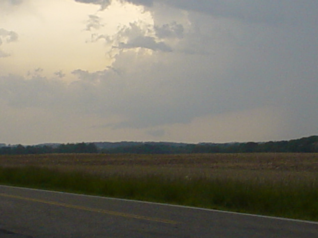 This picture was taken looking due west toward Indiana at about 3:55 p.m. and had a severe thunderstorm warning with it at the time.
 This was taken at 3:57 p.m., with zoom enabled.
 Same storm, 4:00 p.m. Notice a better developed lower base and an inflow "tail" of warm air feeding into the updraft section all the way to the left.
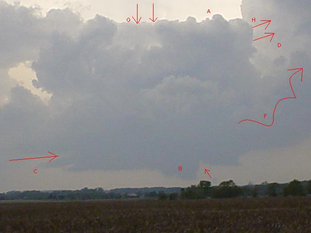 You are looking at the SW portion of the storm from facing west. At A is the area called the rear flank downdraft (RFD) , which is a cold, dry shaft of air that plummets straight out the back end of the storm. These are believed to help the tornado actually get it's "spin." At B, is the actual wall cloud at it's most developed stage with this storm. This is the area that would produce the tornado. The arrow to the right of B is where the air flow into the storm is going vertically up. C along with the arrow, denotes low-level moist air flowing into the storm, indicated by the "beaver tail" cloud appendage at C. At D is the parent thunderstorm. F indicates the mesocyclone's connection to the parent thunderstorm, which would be rotating counterclockwise in a fully developed mesocyclone (which this is not). The area at G shows a flattened, almost block-shaped appearance to the meso. This is due in part to the effect of downward flowing dry air, possibly as a result of a meager RFD. H shows the mid level air flow coming in at a different direction and different speed than the flow at the lower level. This is called wind shear and helps the whole thunderstorm rotate. In the presence of wind shear, the appearance of pre-tornadic and tornadic thunderstorms appear to tilt with the direction of the prevailing mid-level winds.
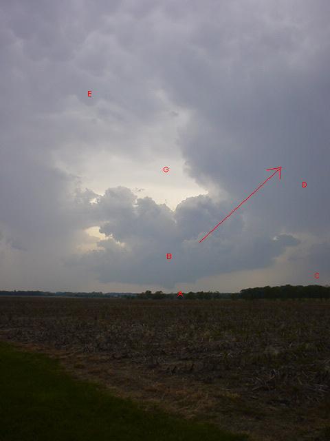 This shot, taken at 4:05 p.m., shows the storm from a wider angle. The lowered base of the storm with a remnant, non-tornadic wall cloud is present at A. Notice the tilted orientation of the storm on its axis to the right as indicated by the arrow. At B is the fledgling meso. C shows the main precipitation core with the storm. D is the parent thunderstorm. At the upper left at E and portions above it is the underside of the anvil with mammatocumulus clouds (after the Latin, mamma for their udder-like shape). These clouds typically form on the underside of the crystallized moisture that is spreading out on the upper reaches of the troposphere, like smoke would flatten out as it floats up to and along the ceiling. They indicate the struggle between cold air on top with warm air trying to incur upward. These tops can sometimes reach up to 60,000 feet. G indicates where the RFD would be.
 This shot was at 4:06. Note some of the structures previously described are rapidly fading.
 The storm at 4:15 p.m. beginning to weaken, although there appears to be a small funnel cloud in the center, it was actually just a scud cloud (a detached, disorganized usually free-floating cloud in the vicinity of thunderstorms).
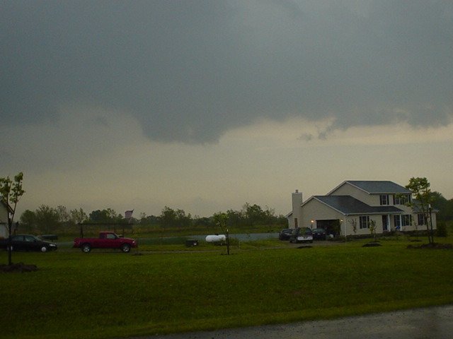
This thunderstorm was photographed about 2 miles east of Oxford, Ohio on state route 73, looking southeast. This thunderstorm had a tornado warning with it 12 minutes earlier for Franklin County, Indiana. There was some minor damage and trees down in that area but no confirmed tornado. There is still the remnant of a lowered base in the left center of the picture.
Not a bad day for SW Ohio, given that the SpenDoc got to see his first meso.


0 comments:
Post a Comment